
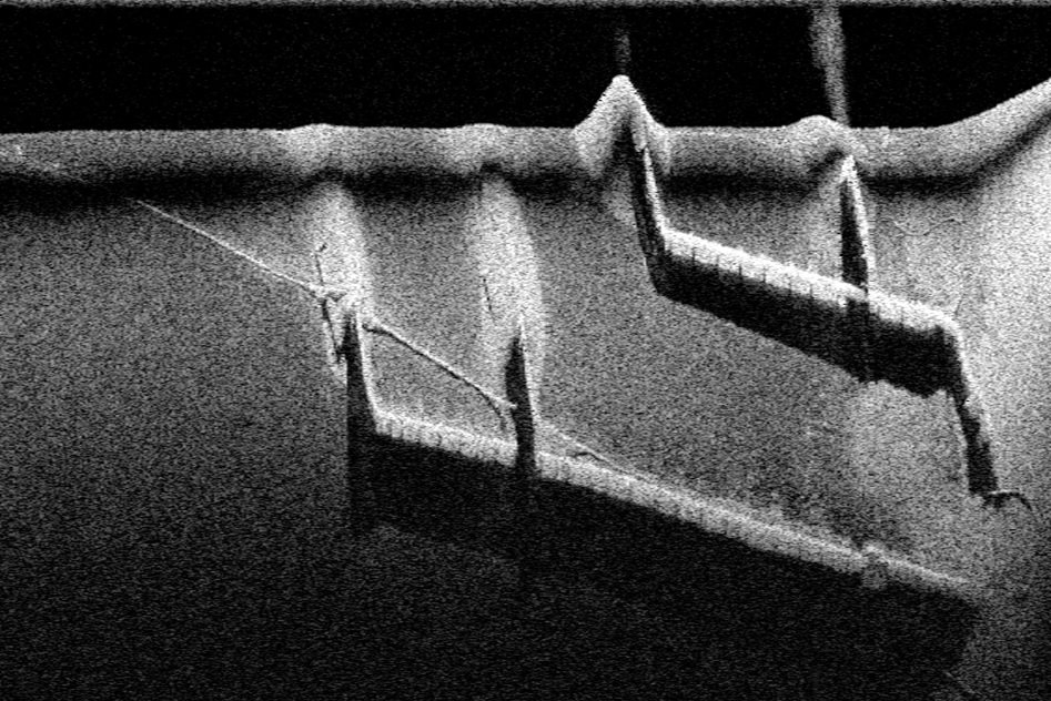
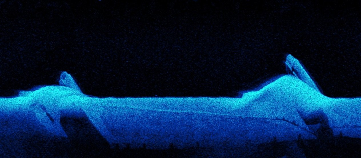
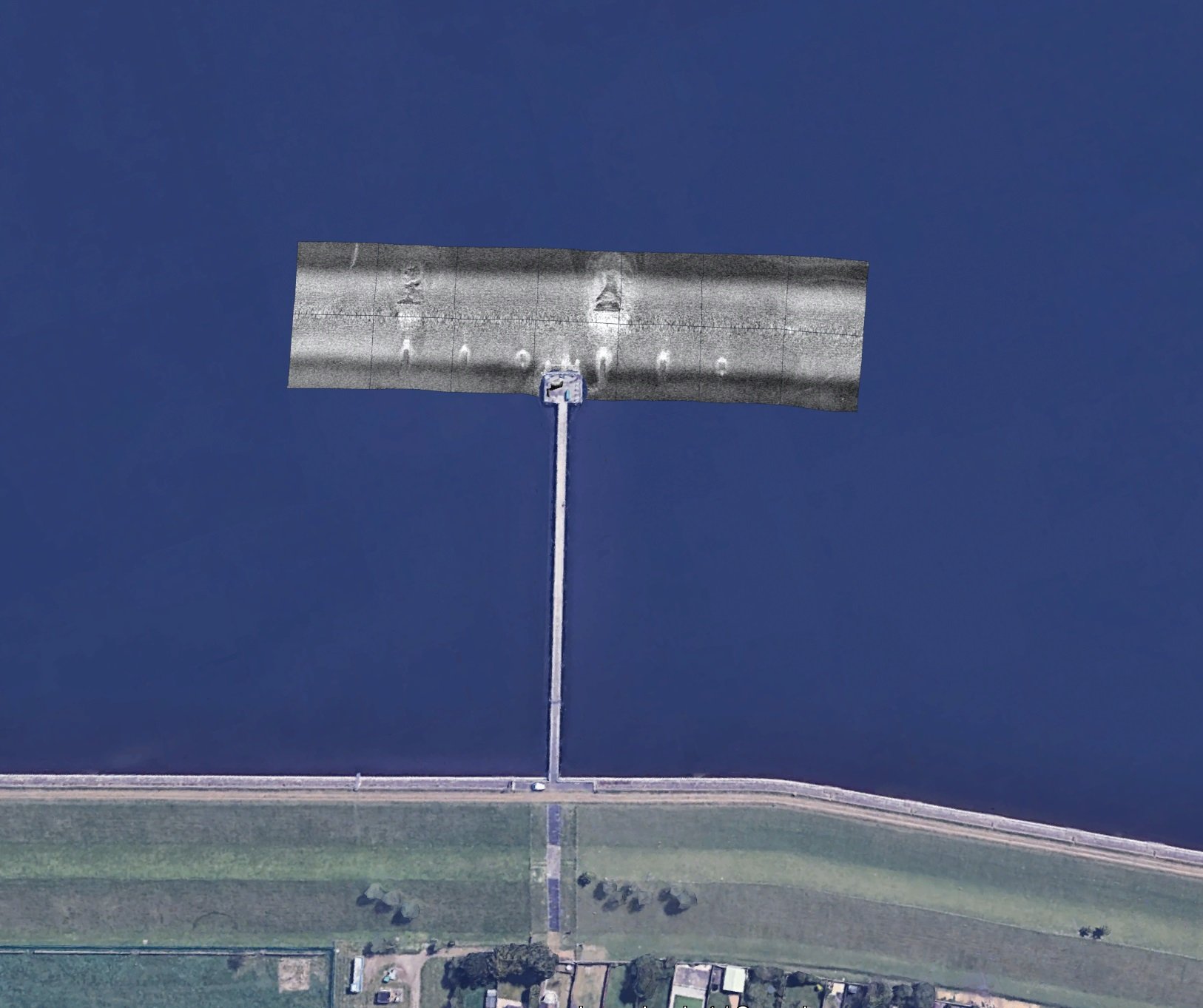
Sonar Surveys & Contouring
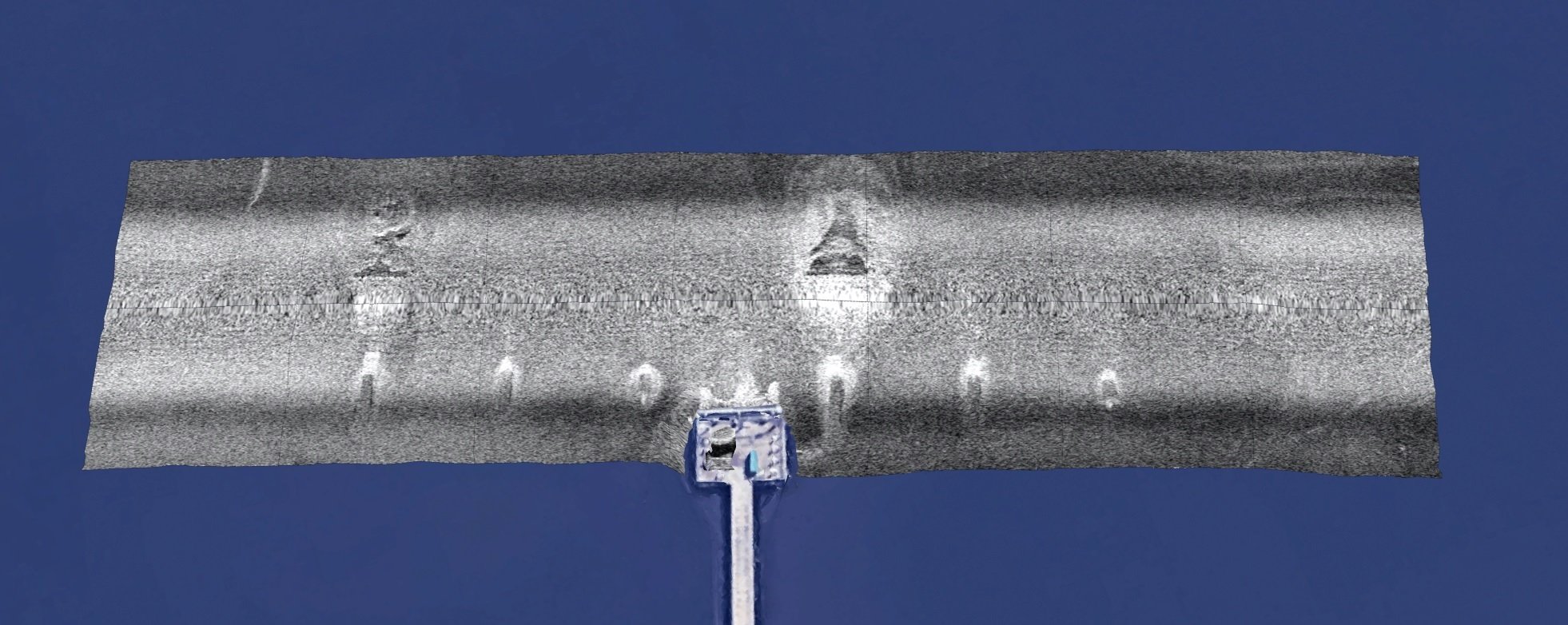
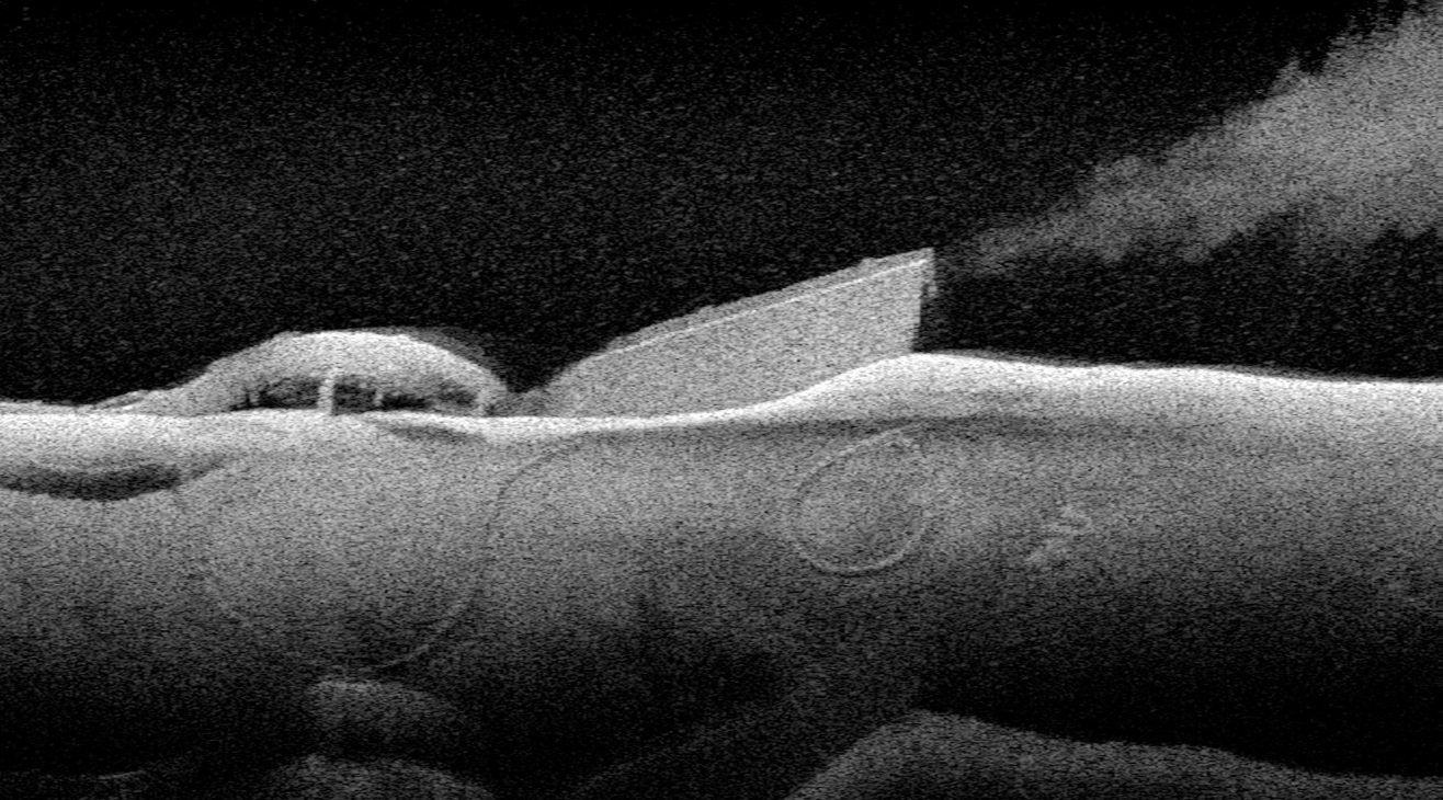
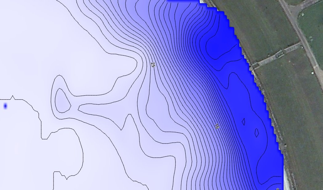
We offer a range of under water survey techniques these include reservoir sonar bed mapping, contouring, down scan sonar mapping and commercial dive surveys.
Ideal for locating outfalls/inlets, raised pipework, submerged culverts, debris and silt mounds.
Our sonar mapping can operate under live conditions with real time data analysis, the images can be overlayed to digital mapping software allowing for accurate longitude and latitude coordinates. Ideal for locating pipe work in preparation for dive surveys, repairs or marker buoy placement.
Non intrusive · Longitude/Latitude Co-ordinates · Dive surveys · Contouring
Real time data analysis